The Crater Lake at the Summit
Why the lake inside Santa Ana's crater glows turquoise, why swimming is banned, what you can do at the rim, and which months give the clearest view.
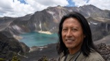 Written with Carlos Hernández, Santa Ana Volcano tour guide & hiking specialist
Short answer
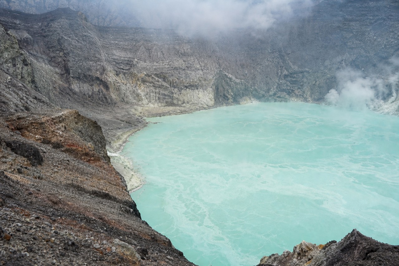
The lake inside Santa Ana's summit crater is turquoise because it is a hot, sulfuric, acidic volcanic pool, not a mountain tarn. Swimming is impossible and prohibited, and rim access is managed by the mandatory local guides. You admire it from the crater edge at 2,381 m. The swimmable lake nearby is Coatepeque.
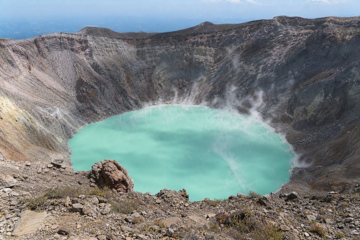
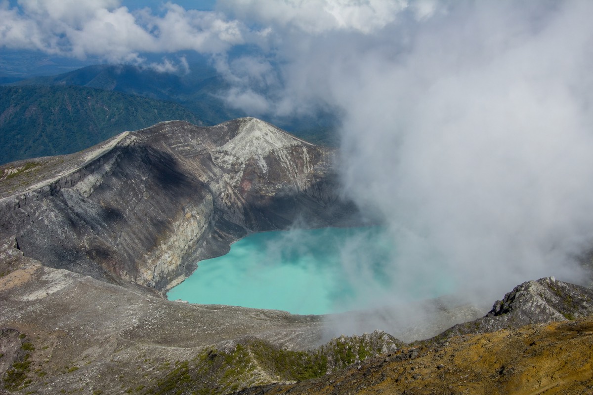
The smell reaches you before the view does. A few steps below the rim of Ilamatepec the wind starts carrying sulfur, and then the ground drops away and there it is: a milky turquoise disc steaming quietly inside a bowl of grey rock, 2,381 metres up. I have guided hikes on this volcano since 2018, and by my own count more than a thousand travellers have stood next to me at that edge. Almost nobody talks for the first minute. The lake does that to people.
This guide covers what the lake actually is, what you are allowed to do once you reach it, and when it shows its best colour.
Why is the crater lake that turquoise colour?
The colour is chemistry, not depth. The summit lake is a hot, sulfuric, acidic pool sitting inside the crater of an active volcano, and the dissolved sulfur and minerals scatter light toward that pale, milky turquoise. The shade shifts with gas activity, cloud and season, which is why no two photos of it ever quite match.
Santa Ana is not a dormant museum piece. It is an active, monitored stratovolcano, and its last eruption came in October 2005. The lake you see today sits in the crater left behind, fed by rain and volcanic activity below, and on most mornings you can watch thin ribbons of steam lifting off the edges of the water. That steam is your reminder that the mountain is still working.
The monitoring is serious and constant. MARN, El Salvador's environment ministry, tracks the volcano through its SNET network, and you can check the current state yourself at snet.gob.sv. As of this writing there are no advisories and no closures. The daily ascents run as normal.
People often ask me why the lake looks electric in one photo and washed-out grey-green in another. Light does part of it. A high sun in the dry season lands on the surface and the turquoise glows; under cloud the same water turns flat and pale. The chemistry does the rest, and I wrote a longer piece on that in why the crater lake changes colour. Short version: you are looking at an acid pool, not a swimming hole, and acid pools have moods.
Can you swim in the crater lake, ever?
No. Swimming in the crater lake is both impossible and prohibited. The water is acidic and sulfuric, the inner crater walls are not a place anyone descends, and rim access is managed by the mandatory local guides. The swimmable lake on this circuit is Coatepeque, the huge caldera lake below the volcano.
The question comes up on almost every hike I lead, because from the rim the water genuinely looks inviting. It has that resort-brochure colour. But the colour is exactly the warning: this is sulfuric, acidic water inside an active crater, and no guide, ranger or sane local will take you toward it. There is no trail down, there is no permitted route, and the prohibition is absolute rather than a rule waiting for a tip.
MARN's own guidance for the volcano says the ascent is "not to be improvised", and the rim is where that matters most. Guides keep groups along the managed viewing stretch of the crater edge for a reason. The rock is loose in places, the wind at the top is stronger and colder than at the trailhead, and the drop into the crater is not survivable terrain. Stay where your guide puts you and the rim is a calm, safe place to spend half an hour.
If what you want from a volcano day is water you can actually get into, you want the other lake. Lake Coatepeque sits below the volcano, about 10 km across, warm, blue and fully swimmable, with jet-ski rental showing up in 2026 reviews. The two lakes make a neat pair: one you photograph, one you swim in, both in a single day.
What can you do at the rim, and what is off limits?
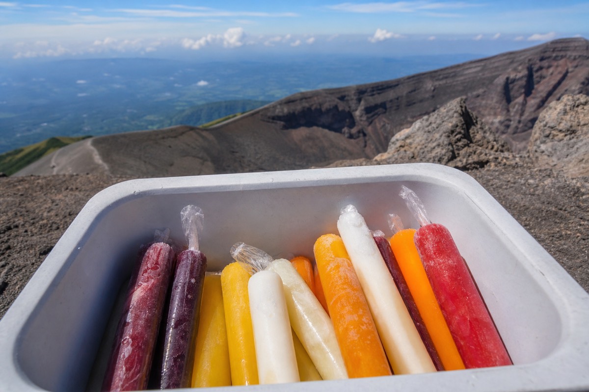
The rim is a viewing area, not a playground. You can walk the managed stretch of crater edge, take photos, watch the steam, and even buy a paleta from the summit vendors. You cannot descend toward the water, wander off the managed section, litter, or stay past the crater closure around 13:00.
Here is the honest split, as it works on the mountain today:
| At the crater rim | Allowed? | Notes |
|---|---|---|
| Walk the managed rim section | Yes | Your guide sets the boundaries |
| Photos and drone-free filming of the lake | Yes | Wind is strong, hold your phone well |
| Buy a paleta from summit vendors | Yes | A 2026 hiker favourite, bring small cash |
| Descend toward the water | Never | No route exists and it is prohibited |
| Swim or touch the water | Never | Acidic, sulfuric, prohibited |
| Leave litter | Never | MARN guidance is explicit on this |
| Linger past closure | No | Crater area closes around 13:00 |
The 13:00 closure surprises people. It exists because the whole mountain runs on a daily group system: ascents start in a window from about 9:30 to 10:00, the last start is 11:00, and everyone is off the crater by early afternoon. That rhythm also happens to put you on the rim in the best light of the day.
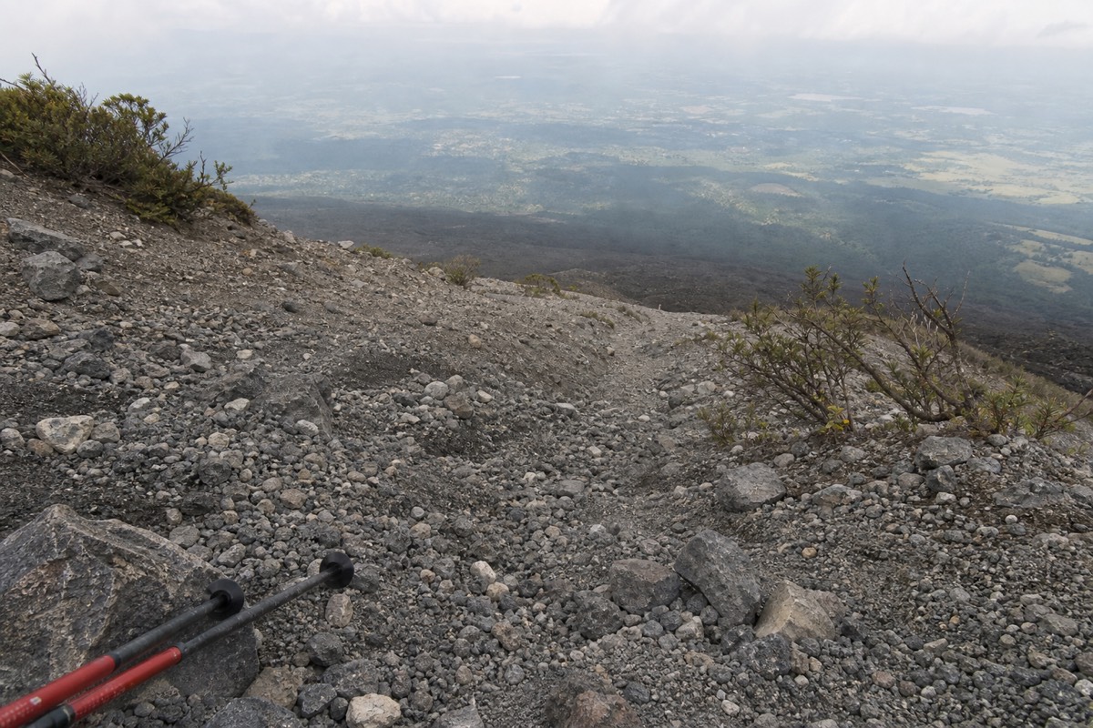
Carry out everything you carry up, keep 2 litres of water on you, and rent the $2 poles at the trailhead if your knees have opinions. The upper trail is rocky, and the descent is where poles earn their money.
How much time do you actually get with the lake on a normal day?
Roughly 30 to 45 minutes at the rim, inside a day that runs on a fixed clock. Trailhead access opens around 7:00, groups form between 9:30 and 10:00, the last start is 11:00, the climb takes about 2 hours, and the crater area closes around 13:00. Everything else in the day bends around that.
People plan the crater lake as if it were a viewpoint you drive to and linger at. It is not. You earn it inside a schedule, and knowing the schedule in advance is the difference between a relaxed rim visit and a rushed one. Here is the shape of a typical day, built from the published window and the trail times, with the usual caveat that mountains and groups both run a little early or late.
| Time (allow) | What is happening | Your job |
|---|---|---|
| ~7:00 onward | Trailhead access opens at Cerro Verde | Arrive, pay cash fees, rent poles if you want them |
| ~9:30 to 10:00 | Daily group forms, guides sort the line | Be present, water filled, layers on |
| 11:00 | Last permitted start | If you are not walking by now, the lake is gone for the day |
| ~2 h of climbing | Forest, then open rocky upper trail | Steady pace, drink, let the guide set the rhythm |
| ~30 to 45 min | The rim and the lake | Photos, silence, a paleta if the vendors are up |
| ~13:00 | Crater area closes | Everyone starts down |
| ~1.5 h descent | Loose rock first, forest later | Poles out, knees engaged |
The window looks strict on paper and feels generous on the ground. Because everybody climbs together in the late morning, you reach the crater around midday, when the light is high and the colour of the lake is at its most saturated. Guides know the pace that lands the group on the rim with a comfortable margin, so a fit walker who simply follows the line does not need to watch a clock at all.
Where the schedule punishes people is at the front end. The 11:00 cutoff has no appeals process, and it is why I keep repeating that transport is the real planning problem, not the hike. The morning group ascent has its own write-up if you want the texture of how those first hours feel from inside the line.
What should you carry to the rim for the lake itself?
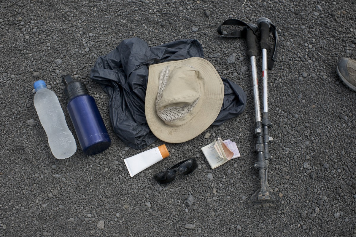
Water, wind protection, sun cover, cash and shoes with ankle support. The summit is cooler and windier than the base, the upper trail is loose rock, and the vendors at the top take small bills only. Trekking poles rent for about $2 at the trailhead and matter more on the descent than the climb.
The rim asks slightly different things of your bag than the trail does, because you go from working hard on a warm slope to standing still in wind at 2,381 m within a few minutes. Most of the discomfort I see at the lake is not exhaustion. It is people who dressed for the parking lot.
| Item | Why the rim wants it | Planning allowance |
|---|---|---|
| Water | MARN guidance is explicit; the climb is warm even when the top is cold | Carry 2 litres per person |
| Wind layer | Summit is noticeably cooler and windier than the base | One packable jacket, worn at the rim |
| Sun protection | High sun at midday, little shade above the treeline | Hat, sunscreen, sunglasses |
| Small cash (USD) | Paletas at the summit, poles at the trailhead, fees at the gate | A handful of small bills |
| Ankle-support shoes | Loose rock on the upper trail and the start of the descent | Sturdy trainers at minimum, boots better |
| Trekking poles | Rented ~$2, praised in 2025 to 2026 reviews | Rent them; the descent is where they pay |
| Phone or camera | Wind is strong at the edge | Strap or firm grip, no drones |
Two things I would add from experience. First, put the wind layer on before you reach the edge, not after you feel cold; the wind at the rim starts the moment the ground drops away, and fumbling with a zipper while your group moves along the viewing stretch is how people miss the best angle. Second, keep the cash somewhere you can reach without opening your whole pack. Paleta vendors at the summit are quick, the line behind you is not patient, and the ice cream tastes better than it has any right to at that altitude.
The full packing list, with what to leave in the hotel, is in what to bring on the hike.
Is it safe to stand above an acid lake inside an active volcano?
Yes, on the managed rim, with a guide, on a day with no advisories. Santa Ana last erupted in October 2005 and is monitored continuously by MARN's SNET network. There are no current advisories or closures, the guide requirement is universal, and the crater edge you visit is a managed viewing stretch, not the crater interior.
The two words that matter are active and monitored. Active is why the lake steams and why the whole day is organized rather than free-range. Monitored is why you can walk up there with a clear head. MARN's SNET network watches the volcano continuously and publishes its state at snet.gob.sv, and the daily ascents run only when that state allows. If a closure were ever declared, the group system would simply not form. There is more on the volcano's status in is Santa Ana volcano active.
The safety questions I hear most at the edge are less about eruptions and more about the ground under people's feet, and here I will speak from my own years on the rim. The rock is loose in patches. The wind is real, and it comes in gusts rather than a steady push. Neither is dangerous if you do the two obvious things: stay inside the stretch your guide has marked out, and keep both feet planted when you turn to look at the view or take a photo. The people who make me nervous are the ones who walk backwards for a selfie. Do not be that person; the drop into the crater is not survivable terrain, and the guides keep the boundary where it is for exactly that reason.
The wider country picture is calmer than many visitors expect. The US State Department currently lists El Salvador at Level 1, "exercise normal precautions", the lowest tier it has, and you can read the advisory yourself at travel.state.gov. On the mountain, the honest risk list is short: sun, wind, loose rock, and your own hurry. A guide, a hat and a steady pace handle all four.
What mistakes do I see at the crater rim every week?
The same five, in roughly this order: arriving after 11:00, treating the rim like a beach, no wind layer, no small cash, and rushing the descent on loose rock without poles. None of them is about fitness. Every one is about planning, and every one is fixable the night before you climb.
By my own count more than a thousand travellers have stood next to me at the edge of that lake, and the errors repeat with such regularity that I could set a calendar by them. This is not a criticism. The mountain runs on rules that are unusual for a hike, and the rim is a strange, wonderful place that makes people forget themselves. But the fixes are simple, so here they are.
| The mistake | What it costs you | The fix |
|---|---|---|
| Arriving after the 11:00 last start | The whole summit, no exceptions | Sort transport for a mid-morning arrival; the bus 248 leaves Santa Ana city ~7:30 to 7:40 |
| Wandering off the managed rim stretch | A sharp word from the guide, and real danger | Stay inside the guide's boundary; the viewing stretch has the best angles anyway |
| Dressing for the parking lot | A cold, hurried rim visit | Pack a wind layer, put it on before the edge |
| Arriving without small US bills | No poles, no paleta, awkwardness at the gate | Cash only, small denominations, kept reachable |
| Descending fast on the loose upper section | Slips, sore knees, a slower group | Rent the ~$2 poles, shorten your stride, let gravity wait |
| Expecting to swim | Disappointment at the top | The swimming lake is Coatepeque, and it comes later in the day |
The one I care about most is the last-start miss, because it is the only mistake that costs you the lake entirely. Everything else degrades the visit; that one deletes it. If your accommodation is in San Salvador, El Tunco or El Zonte, there is no public-transport route that reliably beats the window, which is the practical reason the guided day with hotel pickup exists.
The rest are small, and most groups laugh about them by the time they reach the shade of the forest on the way down. I keep a longer list of first-timer errors in first-time mistakes on the volcano, including a few that happen before you even leave the hotel.
How much cash does a crater lake day cost, all in?
Under $20 if you do it yourself, cash only. Park entrance is $3 for foreigners, the group guide about $4 per person, parking $3, poles about $2, and the bus 248 from Santa Ana city about $0.70. One independent 2025 report came to roughly $17 all-in with summit ice cream. The guided day includes admission and pickup instead.
The crater lake is one of the cheapest world-class views I know of, provided you arrive with the right notes in your pocket. There is no card reader at 2,000 m and no cash machine on the trail. Everything below is paid in person, in US dollars, and small bills make each transaction painless.
| Cost line | Amount (USD) | Who pays it |
|---|---|---|
| Park entrance, foreigners | $3 | Every DIY hiker; included on the guided day |
| Park entrance, Salvadorans | $1.50 | Locals |
| Local group guide | ~$4 per person | Everyone; the guide is mandatory |
| Private local guide (optional) | ~$35 to $40 | Only if you want your own guide on the same rules |
| Parking | $3 | Drivers |
| Trekking poles | ~$2 | Optional, strongly recommended |
| Bus 248 from Santa Ana city | ~$0.70 | Bus travellers, one way |
| Paleta at the summit | Small cash | Anyone with taste |
| Independent 2025 all-in report | ~$17 | A DIY day, ice cream included |
The DIY figure is honest and low, but read the fine print in your own head: it assumes you are already sleeping in Santa Ana city and can catch the 7:30 to 7:40 bus, ride roughly two hours to the trailhead, and then solve your own way onward or back. From San Salvador or the coast the equation changes, because there is no workable public route that hits the window, so your real cost becomes a car, a driver or a tour.
That is the honest split. If you want the lake without owning any of that logistics, the guided day tour covers pickup, the guided ascent with admission, and lunch beside Lake Coatepeque afterwards. If you want the cheapest possible rim visit and you have a night in Santa Ana city to spend, the table above is your whole budget. The full tour-versus-DIY math, with what each option really buys, is in what the day costs.
How does the summit lake compare with Lake Coatepeque?
They are opposites that share a volcano. The crater lake is small, acidic and strictly look-only, sitting at 2,381 m inside an active crater. Coatepeque is a caldera lake about 10 km across where you swim, eat lunch and rent jet skis. The featured guided day gives you both, in that order.
| Summit crater lake | Lake Coatepeque | |
|---|---|---|
| What it is | Acidic, sulfuric volcanic pool | Caldera lake, about 10 km across |
| Colour | Milky turquoise, shifts with conditions | Deep blue |
| Swimming | Impossible and prohibited | Yes, this is the swimming lake |
| Activities | Viewing, photos, paletas at the summit | Lunch, swimming, jet-ski rental (2026 reviews) |
| Access | 6.9 km round-trip hike with mandatory guide | Drive to the shore |
| Time you get there | Roughly 30 to 45 minutes at the rim | About 2 hours with lunch on the tour |
Doing both in one day on your own means solving the ascent window, the drive between sites and a lunch stop with no pickup logistics behind you. This is exactly the problem the featured day solves: hotel pickup from San Salvador, El Tunco or El Zonte, the guided summit hike with admission included, then the lakeside lunch at Coatepeque. If that shape fits your plans, book the guided day tour and check live availability and prices on Viator. It runs at 4.9 stars across 869 reviews, with groups capped at 20 and usually closer to 10.
When does the crater lake look its best?
The dry season, November through April, gives the clearest rims and the strongest turquoise. The green season, May through October, trades some clarity for lush slopes and afternoon cloud, though the late-morning ascent window beats most of that cloud. The summit is cooler and windier than the base in every month.
| Season | Months | What the lake gives you |
|---|---|---|
| Dry season | Nov to Apr | Clearest crater views, strongest colour, big skies |
| Green season | May to Oct | Lush green slopes, afternoon cloud builds, morning window usually clear |
| Any season | All year | Late-morning ascent beats most cloud; summit cooler and windier than base |
I get asked whether the green season is a mistake. It is not. The mandatory schedule quietly works in your favour: because everyone climbs in the late morning and the crater closes around 13:00, you are on the rim before the typical afternoon cloud finishes building. I have had luminous, clear rim views in July. I have also stood in a cloud in January for ten minutes until the wind tore it open. The mountain deals the cards; the timing system stacks the deck. There is a fuller month-by-month breakdown in the best time to hike.
How do you actually get up there to see it?
On foot, with a guide, in the daily window. The trail is 6.9 km round trip with about 470 m of gain, rated moderate, roughly 3 to 4 hours total. A local guide is mandatory, group ascents start around 9:30 to 10:00 with the last start at 11:00, and park entrance is $3 for foreigners, cash only.
The full trail picture lives in the complete hike guide, but the essentials are simple. You start from Cerro Verde National Park, pay your fees in cash, join the daily group with its local guide, and climb about 2 hours to the rim. The last stretch is rocky. Then you get your 30 to 45 minutes with the lake, and you head down before the crater closes.
One 2025 hiker summed up the difficulty better than I ever have: not super easy, but not as difficult as anticipated. That is the honest grade. The official tourism board's page for the volcano at elsalvador.travel calls it one of the country's signature hikes, and the lake is the whole reason why. You climb a mountain and the mountain hands you a colour you have never seen in water before. Bring sun protection, bring cash, and give yourself the minute of silence at the rim. Everyone takes it anyway.