Why Locals Call It Ilamatepec
The Nahuatl name behind Santa Ana Volcano, commonly translated as mother mountain, the 2005 eruption in living memory, and the coffee slopes below the crater.
 By Carlos Hernández, Santa Ana Volcano tour guide & hiking specialist
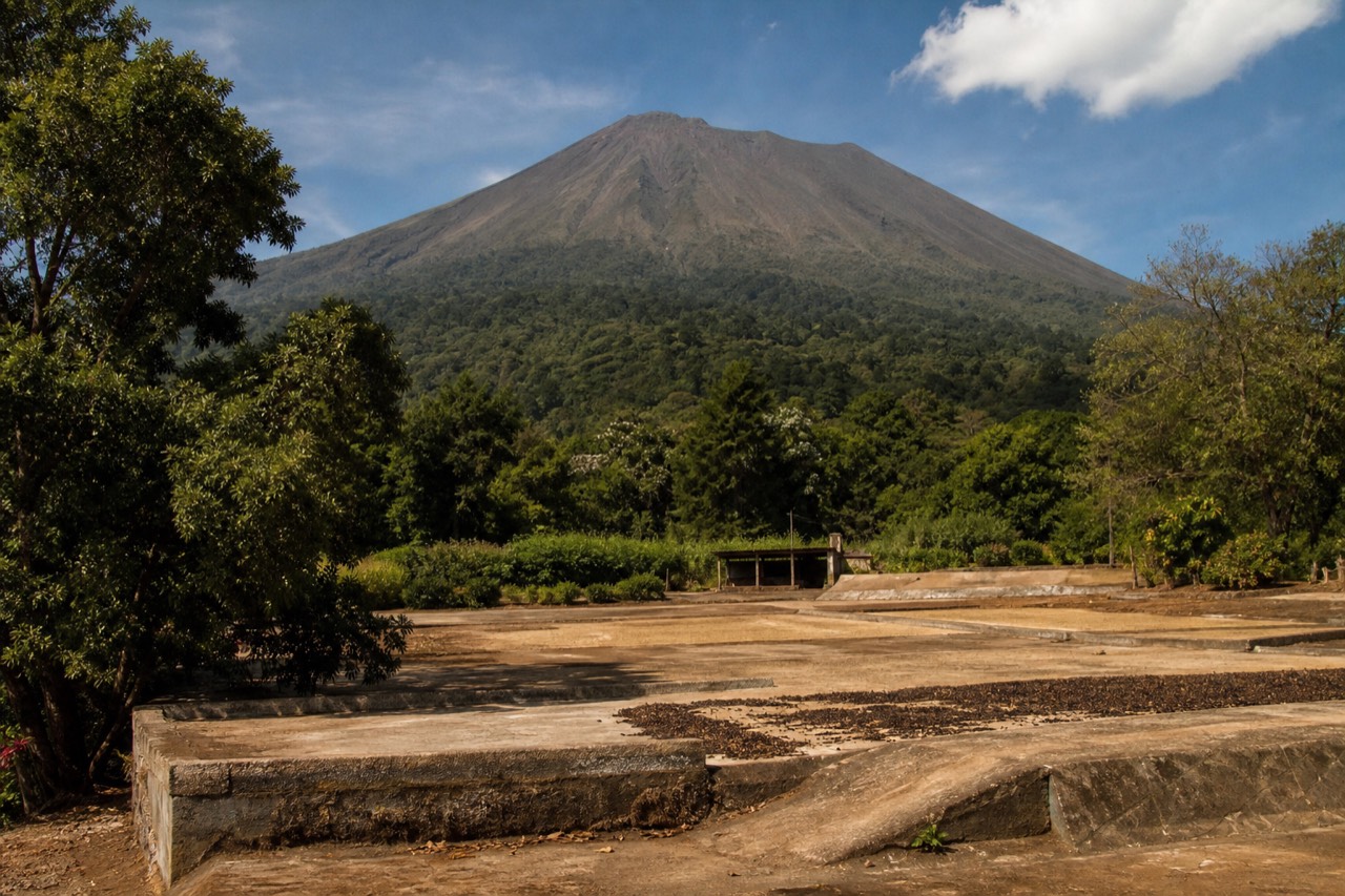
When I introduce myself at the trailhead, I never say we are climbing Santa Ana Volcano. I say we are climbing Ilamatepec, and then I wait for the question, because it always comes. What does it mean? I have been guiding this mountain since 2018, more than a thousand travelers by my own count, and that one word has started more conversations than the crater itself. The old name does something the map name cannot: it tells you how the people who have always lived here see the mountain.
What does Ilamatepec actually mean?
Ilamatepec is the Nahuatl name for the volcano, and it is commonly translated as "mother mountain," with "old woman mountain" or "matriarch hill" also given. The elements are usually explained as ilama, an elder or matriarch, joined to tepec, hill or mountain. Translations vary, but every common version describes a grandmother figure watching over the land.
I say "commonly translated" deliberately, because I am a trail guide, not a linguist, and Nahuatl names carry centuries of retelling. What I can tell you is how the name is used. Guides here, park staff, people in the villages on the slopes: Ilamatepec is the name you hear in daily speech alongside the official one. The Spanish-era name, Santa Ana, is shared with the city below and is what you will see on signs, maps, and the official tourism pages, which themselves print both names side by side.
The neighborhood of names deserves its own little glossary, because three volcanoes stand together here above Cerro Verde:
| Name | Language and origin | Meaning as commonly given |
|---|---|---|
| Ilamatepec | Nahuatl | "Mother mountain" or "old woman mountain"; the elder of the landscape |
| Santa Ana | Spanish, colonial era | Named for Saint Anne, shared with the city at the volcano's feet |
| Izalco | Nahuatl-derived, the black cone next door | Nicknamed "Lighthouse of the Pacific" for the eruptions sailors once steered by |
| Cerro Verde | Spanish | "Green hill," the forested park at ~2,000 m between the three volcanoes |
There is a nice symmetry in that table that guests notice on the trail: the grandmother, the saint, the lighthouse, and the green hill, all within one view. If the geology behind the family portrait interests you, I collected the hard numbers in the volcano facts guide.
What does the mountain mean to the people who live under it?
Ilamatepec is the highest volcano in El Salvador at 2,381 meters, and for the communities on its slopes it is less a landmark than a presence: the maker of the soil their coffee grows in, the weather wall on their horizon, an active neighbor that erupted within living memory and is watched every day.
The "mother" in the common translation is not decorative. People here talk about the volcano the way you talk about a strong-willed relative: with affection, and with respect for her moods. She is generous, the volcanic soil feeds the farms and the forests. She is watched, because everyone over thirty remembers October 2005, when she last erupted. And she is climbed, constantly, by Salvadoran families as much as by foreign hikers, especially on weekends when the group ascent fills with local voices.
That daily group ascent is itself part of the mountain's social life. A local guide is mandatory for every hiker, the community provides the guides for about $4 a person, and the whole system keeps the relationship between the villages and their volcano working. When you pay that small fee in small bills, you are participating in something older and better than a ticket queue. My main hike guide walks through how the system works on the day.
What happened in 2005, and is the volcano safe now?
Ilamatepec last erupted in October 2005, the most recent eruption of an active, monitored stratovolcano that also erupted in 1904. Today MARN and its SNET network monitor it continuously, and there are no current advisories or closures. The managed group ascent and fixed daily window are part of how access stays orderly.
Living memory is the phrase that matters. For my parents' generation, 1904 was a story from grandparents. For mine, 2005 is personal: people in the western highlands remember exactly where they were when the mountain reminded everyone she was awake. Twenty years on, that memory is not fear so much as respect, and it explains the discipline around the climb. Nobody here romanticizes an active volcano. They monitor her, at snet.gob.sv, where the state of the mountain is published continuously, and MARN's standing guidance is that the ascent is not to be improvised.
The timeline, kept strictly to what is verified:
| Year | Event in the mountain's recent life |
|---|---|
| 1904 | Eruption of Ilamatepec, the major event of the older generation's stories |
| October 2005 | The most recent eruption, still firmly in living memory across the region |
| 2025 | El Salvador records 4.1 million international visitors, and the volcano stands among the country's signature hikes |
| 2026 | Active, monitored stratovolcano; no current advisories or closures; daily guided ascents running normally |
If the "is it safe to climb an active volcano" question sits in your head, that is healthy, and I answer it at length in is Santa Ana Volcano active. The short version: monitored, managed, currently quiet, and climbed daily under the eye of the institutions whose whole job is knowing her mood.
How does the mother mountain compare with Izalco and Cerro Verde on the ground?
Ilamatepec is the tallest of the three at 2,381 meters, with a moderate 6.9 kilometer round trip of about 470 meters of gain to a crater lake. Izalco, the black cone next door, is a separate, steeper hike with no lake. Cerro Verde is the forested park at roughly 2,000 meters between them, and the base from which both climbs start.
Guests standing in the Cerro Verde car park often ask which one they are actually climbing. Fair question, since three volcanoes share the skyline. Here is the family portrait as a hiker sees it, not as a geologist would:
| Volcano | Height and shape | The hike | What you get at the top |
|---|---|---|---|
| Ilamatepec (Santa Ana) | 2,381 m, broad, the highest in El Salvador | 6.9 km round trip, ~470 m gain, ~2 h up, ~1.5 h down, moderate, rocky near the summit | The turquoise, sulfuric crater lake and views of the whole family |
| Izalco | The black cone, the "Lighthouse of the Pacific" | Separate, steeper hike from the park | The cone itself; a different day, not a swap |
| Cerro Verde | Forested park at ~2,000 m | Trails around the park rather than a summit push | Cloud forest and the viewpoints toward both neighbors |
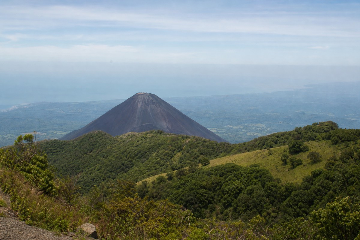
The word "mother" makes more sense from that table. Ilamatepec is the elder and the tallest, Izalco is the young dark cone that sailors once steered by, and Cerro Verde is the green shoulder between them. Everyone who climbs Ilamatepec looks across at Izalco for most of the upper trail, and it is the photograph guests take second, right after the crater lake.
If you are choosing between the two climbs, I wrote out the trade honestly in Izalco vs Santa Ana, and the park itself, with its fees and hours, has its own guide at Cerro Verde National Park. For most first visits the answer is the mother mountain, for a reason the table makes plain: the lake.
What exactly are you looking at from the rim, and what is each thing called?
Straight down: the crater lake, turquoise, sulfuric, and acidic, with swimming impossible and prohibited and rim access managed. Across: Izalco's black cone. Beyond and below: Lake Coatepeque, the caldera lake roughly ten kilometers across where the guided day stops for lunch. Around your feet: the loose rock of the summit, and the paleta vendors.
The rim is where the names in this article turn into things you can point at. I do the tour of the horizon for every group, so here it is in table form:
| What you see from the rim | Name | What to know |
|---|---|---|
| The lake in the crater | The crater lake of Ilamatepec | Turquoise from its sulfuric chemistry, acidic; no swimming, ever; stay where access is managed |
| The black cone across the saddle | Izalco | "Lighthouse of the Pacific"; a separate, steeper hike |
| The forested rise below you | Cerro Verde | The park at ~2,000 m where the day began |
| The big blue lake in the distance | Lake Coatepeque | Caldera lake ~10 km across; the swimming lake, and the lunch stop on the guided day |
| The city in the lowlands | Santa Ana | The Spanish name's twin, and the town the 7:30 bus 248 leaves from |
| The green slopes below the forest | Coffee country | The soil the mother mountain made |
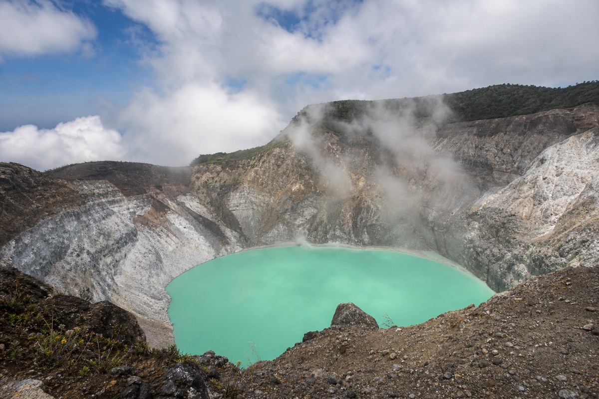
Two lakes in one view confuses people every time, so I say it slowly: the one at your feet is beautiful and poisonous, the one on the horizon is beautiful and swimmable. The tour's day is built on that pairing, climb to see the first, descend to eat beside the second. I put the color science of the crater lake in the crater lake guide.
The rim itself deserves a sentence. It is managed, the crater area closes around 13:00, and the ground is loose rock. The mother mountain gives you the view; she asks that you stay where the guides stand to take it.
What do I wish every visitor knew before meeting the mother mountain?
That she is climbed at her pace, not yours: about two hours up, an hour and a half down, inside a fixed morning window with a mandatory local guide. That she is active and watched daily by MARN, last erupted in October 2005, and currently carries no advisories. And that the small courtesies, small bills, no litter, staying inside the group at the rim, are how the relationship works.
After eight seasons I have a short speech, and it is less about danger than about manners.
Pace. The upper trail is rocky and the group moves as a group. Hikers who charge ahead early tend to be the ones sitting on a rock at the loose section, and hikers who accept the steady pace reach the rim with energy to enjoy it. Poles for about $2 help everyone on the way down.
Respect for an active mountain. Ilamatepec is a monitored stratovolcano, and the fact that you can climb her every morning is the product of institutions doing quiet work; the current status is always readable at snet.gob.sv. MARN's own guidance says the ascent is not to be improvised, carry water, leave no litter. I repeat all three at the trailhead. Two liters per person, and everything you carry up comes down.
The rim. Access is managed and the lake below is acidic. Nobody swims, nobody crosses the line for a better angle. Guests who give the summit ten unhurried minutes, sitting, eating a paleta, saying nothing, are the ones who write to me later. Guests who treat it as a photo stop are the ones who tell me they wished they had stayed longer.
And the name. Say Ilamatepec to your guide and watch what happens. The conversation that follows, about grandmothers and 2005 and coffee, is the culture of this mountain in its most portable form. You will carry it home lighter than a paleta and it will last longer.
Why is the volcano surrounded by coffee?
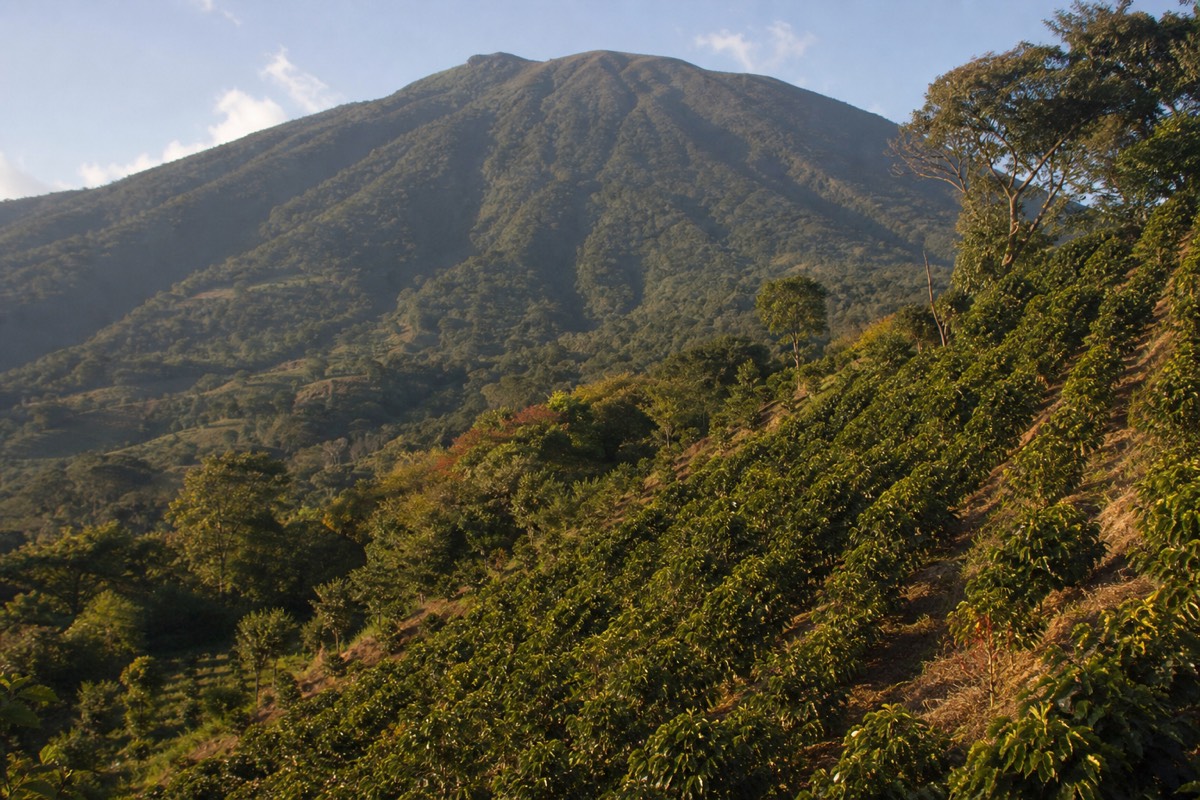
Because volcanic slopes make superb coffee country. The western highlands around Ilamatepec are one of El Salvador's coffee heartlands, and the drive to the trailhead climbs through farms before the trail enters forest. The mountain that occasionally destroys is the same mountain that feeds, which is the whole meaning of the mother name.
Ride toward the trailhead from any direction and you pass through coffee. The approach through the highlands, up toward Cerro Verde at around 2,000 meters, is a rolling introduction to the crop that shaped this region's towns, economy, and pride. Guests from coffee-drinking countries go quiet on this stretch of road. There is something reordering about seeing the plant behind your morning habit growing in the shadow of the volcano you are about to climb.
This is also where the day tour format quietly shines, because the drive becomes part of the story instead of a logistics problem. A bilingual guide narrating that coffee country, then the climb with admission handled, then lunch over Lake Coatepeque: that is the culture and the mountain in a single day. When travelers tell me they want the full Ilamatepec experience without a rental car, I tell them to book the guided day tour and check live availability and prices on Viator, and to sit on the side of the vehicle facing the volcano.
How can a visitor actually experience the mountain's culture?
Use the old name, join the communal ascent rather than wishing it away, buy the small things sold on the mountain, and give the summit a quiet minute that is not a photo. The culture of Ilamatepec is not in a museum. It is in the guides, the vendors, the coffee slopes, and the name itself.
A few concrete ways in, from eight years of watching travelers connect or fail to:
| Moment of the day | The visitor move that opens it up |
|---|---|
| The drive up | Ask your guide about the 2005 eruption; almost everyone local has a story from someone they know |
| The trailhead | Pay the guide fee happily, rent the $2 poles, learn your local guide's name |
| The climb | Walk a stretch near the local guides; the group ascent is a social space, not a queue |
| The rim | Buy a paleta from the vendor who carried it up 470 meters; I wrote that story in my paletas piece |
| After | Say Ilamatepec when you tell people what you climbed |
The last thing I tell my groups at the rim is this. Names are how a landscape remembers. Santa Ana is what the map calls her. Ilamatepec, the mother mountain, as the translation is commonly given, is what she is called by the people who plant coffee in her soil, who watched her wake in 2005, and who walk her trail every morning of the year. Climb her once and you will understand why the old name is the one that sticks.